A Modern Approach to Road Safety in Florida
State transportation departments are a system of continuous improvement, always working toward the overarching goal of developing safer infrastructure for their communities, with a special focus on the most vulnerable users of our roadways: bicyclists and pedestrians. To that end, the Central Office for the Florida Department of Transportation (FDOT) collaborated with District Traffic Operations offices, pedestrian/bicycle coordinators and planning staff to identify 30 corridors statewide that are at risk for fatal or severe pedestrian- and bicycle-injury crashes. To support safety field review analyses and the implementation of countermeasures, the Central Office developed a set of tools for consistency, efficiency and data-sharing across the 30 corridors. To serve as the first use case of applying these new tools, FDOT District 7 called on Gresham Smith to complete the first-round on-site pedestrian bicycle network screening for five corridors in the Greater Tampa Bay region.
Our team out in the field using FDOT’s new set of tools.
The Basics
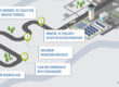
Completely modernizing road safety audits while in the field, one of the tools FDOT developed is an ArcGIS Field Map that operates with two components: a smartphone app and a desktop dashboard that work together to automate field audits in minutes.
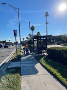
The ArcGIS Field Maps smartphone app is used by the project team during on-site road safety audits to replace the old-school use of paper spreadsheets and plan sheets. While surveying the corridors, we used the app to conveniently plot GPS points with metadata and photograph roadway safety issues. No more clipboards with pages blowing in the wind, no more sifting through disorganized photos in your phone’s camera roll and no more guessing on fuzzy aerials as you make notes.
The app contains an easy-to-follow flowchart of categories for documentation of the corridor including signalized/unsignalized intersections; midblock maintenance, driveways, bicycle facilities and crosswalks; railroad crossings; and bus stops. From cracked sidewalks to drainage issues, the app consolidates the on-site inspection of information with a few quick drop-down menus and brief notes. This reduces the time spent recording observations, and it increases accuracy. Additionally, the Field Maps app updates data points on the desktop application in real time.
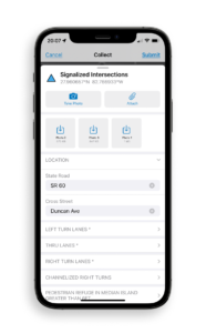 A screenshot showing the smartphone app
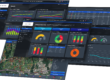
The supplemental ArcGIS Data Reviewer Desktop editor is an amalgamation of all the submitted app data. By compiling the reports, images and details onto one collective dashboard, FDOT staff is able to see the data results for the 30 corridors across all districts and use this information to plan ahead in its work program. For the project team, it makes it very easy to sift through the information collected in the field, with all the details available at your fingertips.
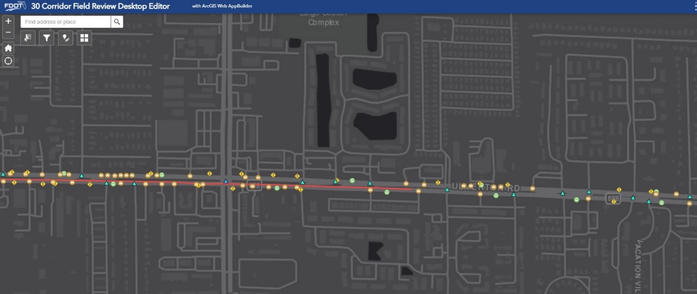
A screenshot showing the ArcGIS Data Reviewer Desktop editor.
Mapping Out the Road to Pedestrian/Bicycle Safety in District 7
We are the first team to test this new application in District 7 on five corridors of varying contexts—from highly industrial with freight traffic to Suburban Commercial with high schools right next door. The team first took a high-level look at the area and conducted a five-year bicycle/pedestrian crash analysis to understand trends along each corridor and identify hot spots. Using the ArcGIS Field Maps mobile app, we were able to efficiently collect observations during morning and evening peak times to truly understand how people were using the corridor and to identify opportunities for safety improvement. The team then referenced FDOT’s new safety countermeasures to make recommendations for improvements.
Looking Through the Same Lens
So far, the program has been used by the Gresham Smith team in five of the districts FDOT identified, and will eventually be used by various engineering firms and FDOT staff to complete the remaining 25 corridors. Instead of comparing apples to oranges as FDOT looks at various firms’ observation results, this is a consolidated tool that formats all reports the same way. The implementation plan will make recommendations for how to use existing projects to build the countermeasures.
Lessons Learned
Using the ArcGIS Field Maps app presents an opportunity for FDOT to improve the efficiency of delivering its studies, which moves projects towards implementation. As the first group to test out this new app for FDOT, consider the following lessons learned as you become acclimated with the process:
- In-House Pre-Planning
When inputting data into the app while out in the field, it can seem tedious to go through the entire flowchart. We recommend building out your key data points beforehand, particularly signalized/unsignalized intersections, existing bike lanes, and transit stops. This can be done using Google Earth and virtually walking down the corridor. This way, you have the shell already built to simply fill in or update while in the field. - Test and Practice
We tested adding data points to make sure that our mobile applications were syncing with the desktop field review editor. It also helped to familiarize ourselves with the drop-downs ahead of time. We found that most of our data was entered under the unsignalized intersections, signalized intersections, midblock maintenance and bus stop categories.
- Sharpen Your Photography Skills
As you’re collecting the information, it’s helpful to not only take detailed photos of what the issue is, but also take photos of the surrounding landscape. This will help give you context and jog your memory of the location further down the line of the project.
- Two Is Better Than One
As there is so much data to collect while out in the field, you need at least two people to perform these types of observations efficiently. Be careful that two people are not editing the same data point though, as this can cause data not to be saved correctly. Also, make sure that all team members interpret the prompts the same way, so that data points are recorded consistently. (We found this was especially important for data entered at bus stops.) - Have Your Camera at the Ready
Have one person with a fast and ready finger to snap a photo when you observe bicycle/pedestrian behavior during your field review. The map application does not have a place to store this data yet, but you’ll want to capture where you see people crossing midblock without a designated crossing or bicyclists riding the wrong way on the sidewalk. This information is invaluable after the field review to inform your recommendations.
FDOT strives to constantly move the needle toward a vision of zero deaths on our roadways. This means thinking differently than we have before and innovating every step of the way.
“We’re excited to see the results of these bicycle/pedestrian studies, and we value the quick turnaround new technology affords us,” says Guttenplan.
Each step we take toward improving how we conduct our field audits and make our countermeasure recommendations is one step closer for safety for bicyclists and pedestrians in Florida.
Amanda Sapala Ladzinski, AICP – Transportation Planner at Gresham Smith
Amanda is a Transportation Planner based in Gresham Smith’s Tampa office. She takes a fresh, value-based approach to active transportation, specializing in urban trail, greenway, community engagement and placemaking planning and design projects. With over 10 years of experience, Amanda understands the intricate processes of project and program management, project prioritization and feasibility analysis, and complex agency and stakeholder coordination. Amanda excels in communicating with clients and empathizing with the public, and she has developed and facilitated numerous in-person and virtual community engagement events, from traditional public meetings to creative and interactive workshops.
David Guttenplan, PE, MSCE – Safety Studies Engineer at FDOT’s District 7 office.
David graduated Cum Laude from the University of Florida with Bachelor’s and Master’s degrees in Civil Engineering with an Emphasis on Transportation. He worked at UF’s Transportation Research Center while attending school. David came to FDOT from USF’s CUTR, where he worked as an Outreach Coordinator providing Pedestrian/Cyclist safety presentations and on-the-street education. He recently passed the P.E. exam early and is eager to make Tampa Bay a more livable community for all modes of transportation with his unique perspective as a professional cyclist.